
It just never ends. They can’t ever have enough transmission, and the “Public” Utility/Service Commissions haven’t seen a transmission they don’t like.
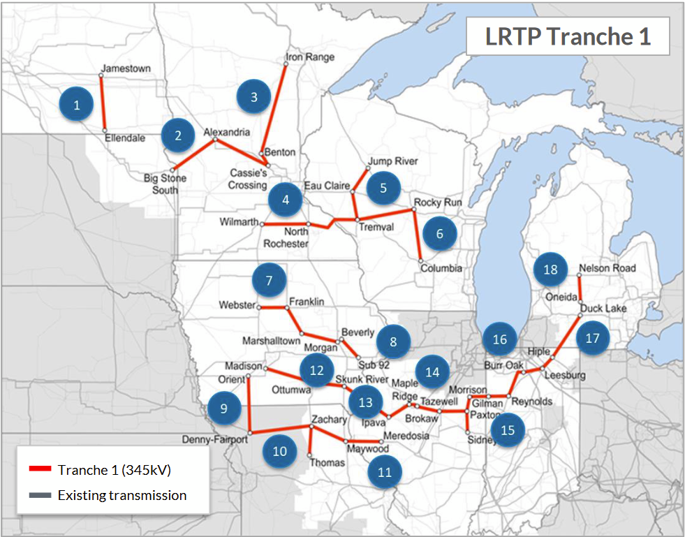
As if CapX 2020 (now “Grid North Partners”) and the MISO MVP Portfolio wasn’t enough, here’s what’s currently in the permitting process — MISO “Tranche 1,” another big collection of high voltage transmission projects, centering on Minnesota. It looks like I’ve got work to do until I drop dead:
The MISO Multi Value Project Portfolio, more huge transmission lines in the Midwest:

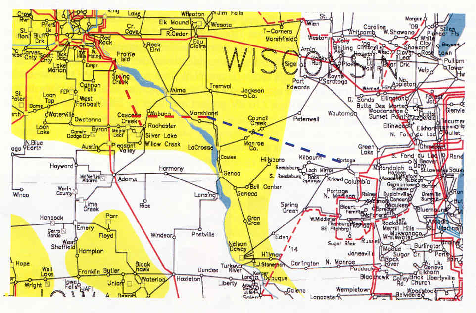
Remember the big picture of CapX 2020 oh so long ago – bulk power transfer from the North Dakota coal fields and generating plants through Minnesota and eastward:

Here’s the basic idea broken down into three projects as found in a September 06, 2005 letter formally announcing the project, a good indication of their intent:
Here are the maps from that letter:


Here are route maps from the Notice Plan, in pdf below the next map. I had to fight like hell to get the existing transmission lines and a likely connector corridor shown on the maps and to have notice sent out to those in that corridor just north of 61 on top of the bluff where it runs east/west. This was a small win, but one step that shows that it’s all connected. The blue part below is the corridor that the existing 345kV line runs along from the square corner it takes near Hampton (soon to be the new Hampton Corners substation) due east to Prairie Island:

Here’re the Notice Plans with their official maps of the potential corridors — everyone owning land within the red sections should have received notice:
CapX – SW to SE corridor map
CapX – SE Minnesota corridor map
If CapX’s SE line goes to Prairie Island and then south, it would either take a square corner to go south on top of the bluff where the existing line from Hampton meets the line coming out of Prairie Island, or it would join the existing line from Hampton as it goes down the bluff toward the reservation and Prairie Island nuclear plant.
Here’s a photo that they included in the original Notice Plan to the PUC showing the route proposed (and I don’t think it’s changed a bit, but please, convince me I’m wrong). Here’s the map in pdf so you can print yourself a big copy:
From Prairie Island or the bluff, it would then go south, along the existing Prairie Island-Byron line, right through the new Westwood subdivision. Has someone told the developers and realtors selling lots and homes? You betcha… I have… by phone and email. Are they giving notice to prospective buyers? Good question!

Comments
Maps – CapX 2020 — No Comments
HTML tags allowed in your comment: <a href="" title=""> <abbr title=""> <acronym title=""> <b> <blockquote cite=""> <cite> <code> <del datetime=""> <em> <i> <q cite=""> <s> <strike> <strong>