Notes from Friday
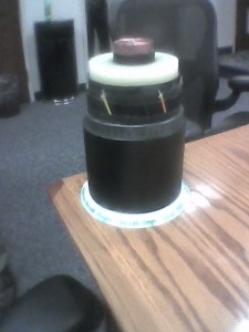
Conductor on loan from New England
Judge Luis has taken my subpoena request under advisement — I’m wanting to have Fish & Wildlife come in and explain their position on the impacts of CapX crossings over the Minnesota River. Now that the letters are public, at least a few of them (are there more?!?!) and there are serious concerns voiced, and since we’ve had some important testimony from the DOT’s Dave Seykora, I don’t think it’d be right to go forward without hearing from US Fish & Wildlife in person. We’ll see…
Here are the “Fish & Wildlife” letters that I have thus far – note the statements about “non-aerial” crossings, particularly in the April 30, 2009 letter:
And as for notes, well, they’re sketchy because I’ve got a cold and was hacking wheezing and snotting through the day:
And here’s something choice from the EMF Department, let’s walk through this. In the application, in the EMF part of Section 3, on p. 3-19, they say that the EMF modeling is based on 2010 levels. In a response to Johnsons’ IR Request 7, they said, in paragraph C, that the corrected year is 2011, not 2010. OK, right… and so I asked Lennon when the inservice date was, and he said parts in 2013, parts in 2014 — OK, right… modeling for 2011, two to three years BEFORE the line is inservice?!?! What kind of results would that give?
But wait, it gets weirder. They said the line loading would increase over time (DUH!). But where’s the modeling for that? NOWHERE!!!
In that same part, p. 3-19, they also note the line is spec’d at bundled 954 kcmil ACSS, and here’s chart from Certificate of Need proceeding showing the Summer amp and MVA rating:
And the snippet of the IR3 chart with the relevant amp & MVA levels:
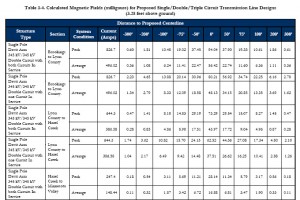
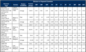
And the Applicants provide this chart on EMF levels (this will just be a snippet of that chart, which begins on p. 3-20 through 3-22 — LOOK AT THE AMPS:
You can find the narrative and charts in their Application, Section 3, p. 3-19 through 3-22 to see for yourself:
Engineering Design, Construction and Right of Way Acquisition
Now let’s go over this once more with feeling…
- Applicants use 2010 or 2011 and say that magnetic fields were calculated for “current flow at the conductor’s thermal capacity and average flow.”
- Line isn’t scheduled to be inservice until 2014 or 2014.
- Applicants admit loading will increase as load growth occurs.
- Thermal limits for line is 3700 amps and 2211 MVA (testimony in the Con said it should be 2050MVA — let’s use that, it doesn’t make htat much difference.
- Their EMF chart says, for example, that for the Brookings to Lyon County, the current level is 826.7.  EH? Oh, think that’s just a low level… OK, let’s look at the highest:
- The highest I can find is for the Lake Marion to Hampton section, at 1005.9.
- 1005.9 is about 3.7 times less than the thermal limit for the line.
- Lennon testified that at any given Magnetic Field level, if it’s double the current, it’s double the magnetic frequency (rough, remember), if amps are three times, it’s roughly three times the magnetic field.
- So for the peak, the thermal limit, the magnetic frequency at the edge of the RoW,for EMF at amps of 3,700, at 3.7 times the level they claim, it would be around 24 x 3.7, or 88.8.
- MOES/Department of Commerce accepted Applicant info and did no independent verification.
Given that, what are the magnetic field levels 75 feet off the RoW?
Given that, how stupid do the applicants think we are?
Given that, why is MOES putting anything into the EIS that’s so patently absurd?


Comments
Notes from Friday — No Comments
HTML tags allowed in your comment: <a href="" title=""> <abbr title=""> <acronym title=""> <b> <blockquote cite=""> <cite> <code> <del datetime=""> <em> <i> <q cite=""> <s> <strike> <strong>